
This walk begins at almost the same spot as walks 6. Greenwich Road and 8. St Leonards and Artarmon, at a point on the bottom of the hill on River Road. This is a sort of crossroads of this area, as it's on the boundary between the suburbs of Wollstonecraft behind us to the east (part of the North Sydney Council local government area) and Greenwich ahead to the west (part of the Lane Cove Council). The welcome sign here is a sign indicating the Lane Cove Council area, although the suburb of Lane Cove itself doesn't start here - we'll be going there in this walk.
The sign is an interesting rustic construction of three elements: a sandstone base, wooden pillar, and natural rusty iron sculptural elements.

We saw the eastern end of River Road in the first photo of walk 9. Crows Nest and Cammeray. In walk 6. Greenwich Road we turned left (south) off River Road shortly after the previous photo, while in walk 8 we crossed the road and turned right (north). Today we're walking west, straight up the steep hill of River Road. The plan is to follow River Road to its far end! At the top of the hill you can see traffic lights, marking the intersection with Greenwich Road.

And at the top of the hill, the road plummets back down an even steeper slope. From here you can see the line of the Blue Mountains on the horizon west of Sydney! The mountains are about 50 km away.

Partway down the hill is Hazelhurst, a heritage listed house because of its "eclectic stylistic origins". It was built in this quirky Federation style by the father of the 2010 owner (as of the original heritage listing), and is in excellent repair. Except for the sandstone gate pillars, which have skewed and are no longer in alignment.

Further along the road is this place, which hasn't been so kindly dealt with. Whatever was behind this still extant old sandstone wall has been demolished and redeveloped into a modern duplex.
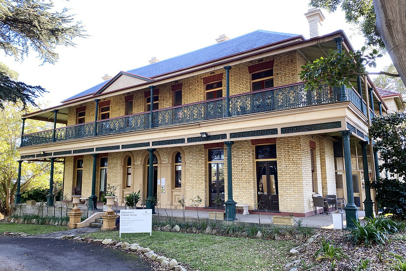
Down the hill and over the far side of the next hill, on the southern side of the road is Greenwich Hospital, a private hospital. It's partly on the grounds of a former private girls' school, the original building of which is Pallister House, this beautiful late Victorian house which was originally built in 1892 for a prominent businessman, Mr John St Vincent Welch and his family, who named the house Standish.
Additions were made to the rear of the house in 1937-38 when it was converted into an Anglican girls' school. In 1946 the school closed and the property was acquired by the Church of England, who changed the name to Pallister and operated it as a home for orphaned girls. By the 1970s, Greenwich Hospital had sprung up on the adjacent land, almost surrounding Pallister. In 1981, the girls' home was closed and Greenwich Hospital acquired the building, which was heritage listed in 2006.

A little further along is the more modern main front building of Greenwich Hospital.
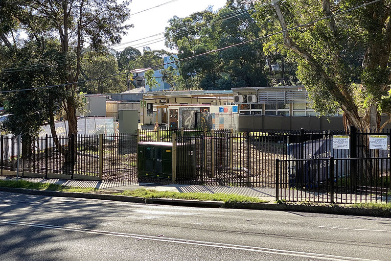
Across River Road from the hospital, on the northern side is Greenwich Public School, a primary school. It's currently being expanded to handle an increased number of students, as part of a plan to deal with many additional families moving into the area because of nearby property redevelopments turning old houses into new apartment blocks.

As well as undulating up and down the hills, River Road snakes north and south a bit as it wriggles westwards. Here is a lovely liquidambar tree, offering the only visual evidence of autumn in a land of otherwise evergreen trees. Here the land to the left drops off into a forested gully of Gore Creek, which we walked through at the beginning of walk 5. Gore Creek, and there is no pedestrian path on the left side of River Road, so we stick to the northern side as we continue walking.

That leads us down another hill, hugging a sandstone cliff wall on the right. There are signs here warning traffic of the potential for falling rocks off the cliff.

At the bottom of this hill we leave Greenwich and enter the suburb of Lane Cove. Gore Creek flows from the bushland on the right, downstream to the left, underneath the road. The squat, blocky wooden sign jet left of the silver car at centre marks the start of the bushwalk track we took in the previously mentioned 5. Gore Creek. Past the creek River Road climbs up yet another hill!
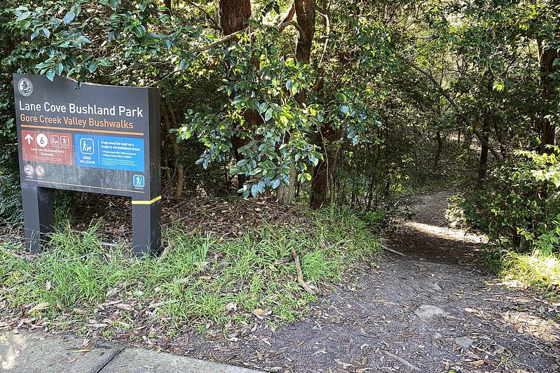
There are also bushwalking tracks on this northern side of the road. This sign marks the entry path.

Just beyond the bushland area is Lane Cove Golf Course. I only started learning to play golf less than a year ago, and this is the closest golf course to my home, so I play here a bit. It's a small 9-hole course, tucked into a narrow slice of land running along Gore Creek, operated as a public course. Anyone can go in and play a round here at almost any time. In this view we're standing behind the tee for the 9th hole, played towards the clubhouse, visible in the distance. There are also tennis courts up there, behind the hedges, with the floodlight poles above them.

River Road continues up the hill past the golf course. The southern side of the road is very steep, as you can see! This house, number 143, has its front gate and carport at the bottom, and then this daunting set of stairs up to the house. Imagine carrying your weekly groceries up there! (The house at the bottom in front of it is 141, the next door neighbour.)

Halfway up the hill is the entrance to the Lane Cove Golf Club.
Cresting the hill we reach the western end of River Road! This photo is looking back east the way we came - River Road curves down the hill to the left. The road leading straight ahead and behind us is Northwood Road, although the way the intersection is configured River Road merges into the busy part of Northwood, while the quiet part of Northwood leads off the other way.
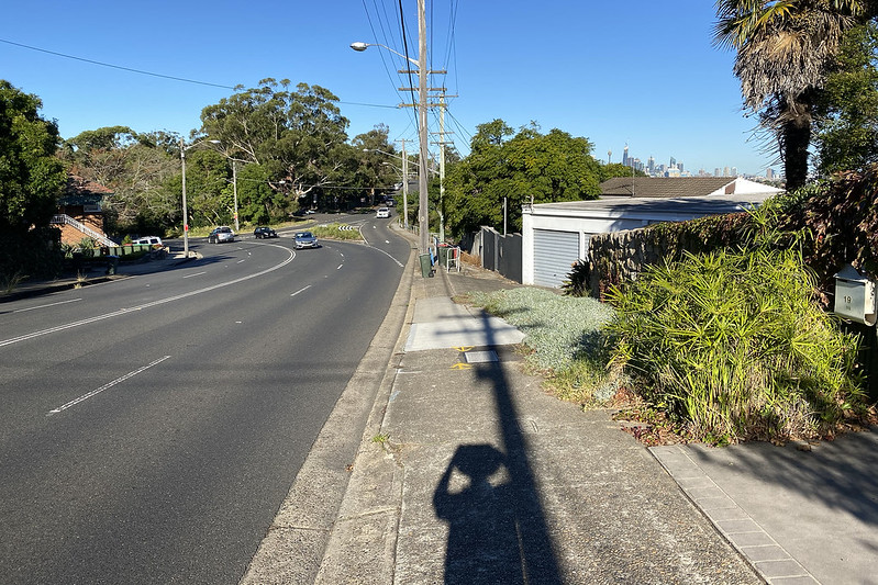
This view looking south-east shows the tall buildings of the centre of Sydney in the background on the right.

Looking south-west from almost the same position gives a view over part of Parramatta River, the inner estuary part of Sydney Harbour, and suburbs in that direction. There's also an intriguing pedestrian path leading down the hill between a couple of houses (you can see the white railing for the steps) - a path I've never walked on before! Let's follow it!

It leads us down the hill to Arabella Street. This street is chopped in half by the slope. This is a fairly common sight in hilly suburbs.

We turn and walk up Woodford Street. And I mean up... this street is steep. But looking back gives us this marvellous view of the city.
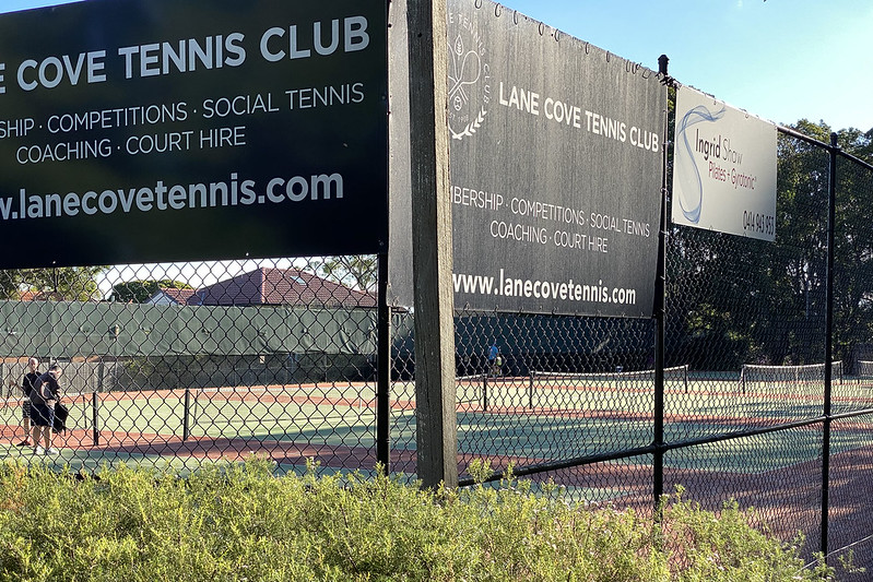
Turning into Kenneth Street we find more tennis courts. This is the Lane Cove Tennis Club.

And this small park. Which is called Central Park. Not quite as impressive as the one in New York City.

Kenneth Road leads us back to Northwood Road, where Porters Liquor store is. I come here sometimes to buy bottles of wine. The service is friendly.

Across Northwood Road is the Riverview Animal Hospital, which is a branch of the veterinary hospital that Scully goes to. It's closing down this week and moving to the new premises we saw in walk 16. Crows Nest shops, so that this old building can be demolished (and presumably turned into new apartments). Out the back of this building is Scully's doggie daycare, which is also moving premises this week.
This corner where several important streets meet is often referred to as "Riverview", although it's in the suburb of Lane Cove, and there is an actual suburb named Riverview further west.

North past an intersection we segue into Longeuville Road, heading north. From the intersection just behind us, River Road makes a miraculous recovery and continues further west as River Road West, but that's too far for me to walk in one day, so we're going to start turning around here to head home. Longueville (pronounced "long-a-ville") leads north to the shopping area of Lane Cove, but we're not going that far today.

This building looks like an old Masonic temple. But it's been converted recently into a Buddhist temple.

We walk north only as far as Richardson Street West, where this old house is on the corner.

Richardson Street West is a dead end, leading downhill... to the Lane Cove Golf Course!
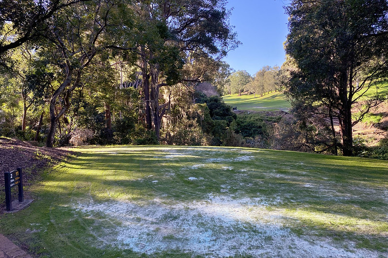
The grassy/sandy area on the left of the previous photo is the championship tee location for hole 2 of the golf course. This is the view from the tee, in the direction you're supposed to hit the ball, over that gully to the fairway beyond. The regular, non-championship tee is over on the far side of the gully - that's where I play from! This championship tee adds a good extra 50 metres to the length of the hole.

We're going to walk right across the middle of the golf course. The course is very narrow, especially here, where there are paths connecting holes 1 and 2 heading north, and 6 and 7 heading back south. This view is looking south from the tee of hole 7, hitting ahead and left into the photo. The yellow flag at right marks the green for hole 1.

Across the golf course, we emerge into Richardson Street East, on a direct straight line across from Richardson Street West, interrupted by the golf course.

Rather than go up the street, we turn right (south) into this bushwalk track, which runs along the northern edge of the golf course. Eventually it joins up with the Gore Creek bushwalk tracks we saw earlier.

Someone left an old... rusty iron tub(?) here.

The track gets pretty bushy.

But the golf course is not far away.

In fact it's tantalisingly close at times. But you can't get from the track down to the golf course without a machete. And possibly climbing equipment.

This is what you have to deal with.

Until right at the end, near the 9th hole tee, where there is a series of steps leading down to the course. That's River Road in the background, and we're just a few metres from the earlier photo above, where we saw the golf course for the very first time. Here's a good place to finish this photo walk, since now I have to retrace my steps to get back home.
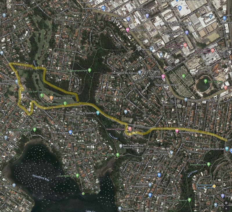
Map of this walk. Starting at the right, walking west and then clockwise around the loop.