
This walk begins in the suburb of St Leonards, adjacent to St Leonards railway station, at the intersection of the Pacific Highway and Herbert Street. The train line runs underneath the highway, and the station is inside the building on the left.

We're walking north up Herbert Street, roughly parallel to the train line, which is on our right. The station building is therefore now on our right. The pedestrian overpass leads from the station to Royal North Shore Hospital on the left.

This old Federation Queen Anne/Arts & Crafts style house is part of the hospital grounds. You can see the new hospital building behind it on the left. This house was used as a drug detox clinic until a few years ago, when the clinic moved to a brand new building nearby. Now it looks abandoned. I did a heritage search, but this building isn't listed, so perhaps it will be demolished at some point.

Past the hospital on the left side of Herbert Street is this Australia Post delivery centre. Sometimes when I get packages delivered and am not not home, I have to come here to pick them up. (Other times I have to pick them up from one of the two nearby post offices - it seems totally random which of the three facilities is chosen.)

Further north along Herbert Street. This is a light industrial area, with office parks and so on. Directly ahead is the Reece plumbing showroom, showing off bathroom and kitchen fittings.

I mention the old Reece plumbing showroom because it's moving to new premises just a bit further along Herbert Street. This used to be a Tesla dealership, but is now being refitted as a plumbing showroom. I guess Teslas aren't that popular here.
Just after this building is a cross street, and we cross over from St Leonards into the suburb of Artarmon.

The first building on the Artarmon side is the headquarters of SBS, one of the major broadcasting services in Australia. SBS makes television and radio shows, catering to multicultural and fine arts audiences. It's one of Australia's highbrow broadcasting networks.

Looking north along Herbert Street. We actually go downhill for a little bit.

On the right side is North Shore Vet, which is Scully's vet.
I've mentioned Scully's vet several times in these walks... because they have two branches, and both of them very recently moved. We saw the old premises for this branch in Walk 14. Artarmon, Naremburn, St Leonards grunge. For the other branch, the old premises was in Walk 18. Riverview and the new premises were seen in Walk 16. Crows Nest shops.

Herbert Street continues over this overpass, above the Warringah Freeway (which we've seen and crossed in other places on several of the other walks).
This panorama has a couple of amusing stitching errors with the moving cars on the left side.

On the north side of the overpass, the street continues but changes name to Hampden Road. Uphill again, yay.

At the top of the hill is Artarmon Community Tennis.

Hampden Road eases back downhill towards the Artarmon shopping strip. In Walk 14. Artarmon, Naremburn, St Leonards grunge - we saw the industrial side of Artarmon, south of the freeway, but there's also a residential and commercial area on the northern side of the suburb, across the freeway. The trees on the right hide the train line which runs from St Leonards.

A look at the shops along the shopping strip.

Artarmon station, glimpsed through the concealing foliage, looking back down the line to the south towards St Leonards. The station was built in 1916, in a style typical of many existing Sydney suburban stations of the era. The station is heritage listed.

Shops further down Hampden Road.

At the far, northern end of the station is the access to the platforms, via this underpass tunnel. Stairs lead up to the platforms from the middle of the tunnel. (There are also modern lifts installed in 2015, for people who can't climb stairs.) We walk through this tunnel to the eastern side of the station.

On the eastern side is this little square full of restaurants.
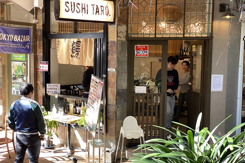
I'm here today because I'm meeting a friend for lunch at Sushi Taro. This was in fact the inspiration for doing this walk today.

I'm a bit early though, and very hungry, so I order some gyoza to eat while I wait for my friend to arrive. I intended to take a photo of my main meal as well, but when it arrived I was so hungry that I dug straight in and forgot to get a photo.

My friend was doing a cycling trip, and departed after our lunch, while I continued walking. We head east along Elizabeth Street, which turns into Burra Road at that bend on the right side of the photo.

Here's Burra Road, looking east. Just suburban houses. There are a few nice ones along here - it looks like most were built around the 1940s or so.

At the end of Burra Road is the entrance to Artarmon Reserve. You need to go down this little driveway to get to it.

There's a nice big children's playground here.

Artarmon Reserve is mostly this large grassy area. Which is a bit muddy due to recent rain. There are four rugby/soccer fields laid out here in a square pattern. When not used for sport, it's an off-leash dog park, and there are a few dogs here today.

The fields are also used for cricket matches in the summer, and you can see one of the cricket pitches (the brighter green strip in the middle of the grass). I didn't look up close, but I suspect that's a strip of artificial turf designed for use as a cricket pitch - much easier to maintain than a natural turf pitch.

This path going around the left of the playing fields takes us to the main part of today's walk.
We head south and cross under the Warringah Freeway (sound barriers visible on the overpass). This leads us to the bicycle/walking path that we followed in Walk 14. Artarmon, Naremburn, St Leonards grunge. Today we follow that same path again for a short distance, as far as the sandstone tunnel through which Flat Rock Creek flows.

This tunnel (photo reproduced from Walk 14). On that walk we didn't go through that sandstone tunnel. Today we do, and follow Flat Rock Creek. We've now crossed from Artarmon into the suburb of Naremburn.

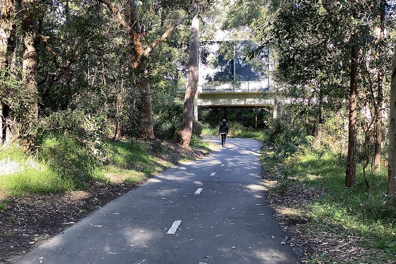
Here we are on the other side of the sandstone tunnel. This is the Flat Rock Gully Walking Track. I've never been on this track before, so this is quite exciting! It turns out to be a paved cycling track at this point, and apparently quite popular with people out for some exercise or to walk their dog.

A bit further along it passes very close to the back yards of some houses. It's not entirely clear to me where the creek is at this point, but maps show it running along this route, so presumably it's either hidden in the foliage, or perhaps running underground in a pipe.

Quite a nice walk, really.

Along this walk is Henry Lawson Cave. Not really a cave, but really just an overhanging slab of sandstone which would provide some shelter during rain. The carved sign has a likeness of the poet Henry Lawson carved onto it.

Henry Lawson is perhaps Australia's best known poet. He was pictured on our original paper ten dollar note (although he was replaced by poet A.B. "Banjo" Paterson for the redesigned polymer ten dollar note). He lived in nearby Naremburn in 1906-07. According to this plaque, he liked to have a few beers at a Crows Nest hotel (not the Crows Nest Hotel, seen in some of these walks, which was built later), and then wander up here (about a mile to the north) to sit under this rock and contemplate life, and presumably come up with ideas for poetry.

A little further along we come across the Flat Rock baseball field. Baseball is not popular in Australia, and this is the only dedicated baseball field I can think of in Sydney.
(A Google Maps search shows about a dozen baseball fields in Sydney - population 5.3 million - but almost all of them are just corners of football or cricket fields, with only this and one or two other dedicated baseball facilities.)

A view of the baseball field with the walking track running along the side.

There's an interesting piece of art here. According to the plaque, the three sides (only two visible here) show the past, present, and future relationships between the immigrant population and the indigenous Australians.

That might be the creek there, running through that grated pipe. Here the walking track goes underneath a road (Flat Rock Drive).

On the eastern side of Flat Rock Drive, the path splits. The paved path apparently leads to a nearby street and ends there. But we're going to take the unpaved path on the left.

Suddenly we're deep in bushland, apparently untamed, except for glimpses of expensive houses perched on the cliff top way above.

A sign welcomes us to Flat Rock Gully. Here's where the real fun starts.
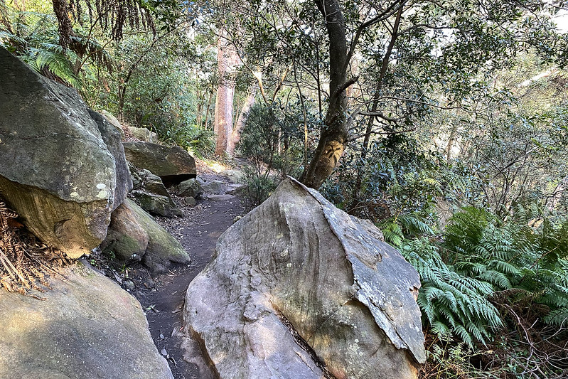
This is the Wilksch Walk, named after Eric Wilksch, a local resident who fought to have this area preserved in its natural state rather than be developed. Looks like he did a good job.
The path is well maintained, but fits in well with the natural setting. It feels a bit like walking through Middle-earth.

We come across Flat Rock Creek. Here it looks like a proper creek. The water looks clean (although I wouldn't drink it), with no obvious litter anywhere. It looks like somebody keeps the place clean of the inevitable discarded drink bottles and so forth. Good to see!

A panorama of the creek.
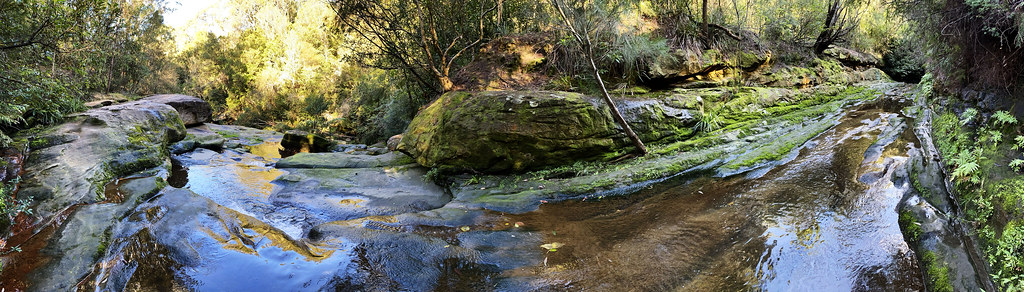
It's gorgeous! I couldn't stop taking panoramas.

We follow the creek downhill, alongside little cascades over mossy rocks.

This is a beautiful walking track! I can't believe I've never tried this track before.

The path crosses the creek, across this flat rock... Flat Rock Creek, hmmm? You wouldn't be able to cross here during heavy rain, I suspect. (In fact there's a warning sign to this effect nearby.)

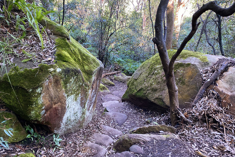
The path continues downhill.

There's an old sandstone retaining wall along the left here. But so old that it's totally covered in moss. Still virtually no trash or pollution visible. This is amazing for a creek in the middle of suburban Sydney.

Reflection in the water.

Eventually we reach Long Gully Bridge. We stood on top of this bridge during Walk 9. Crows Nest and Cammeray. It was a long way down to the gully below, and now we're down here it's a long, long way up to the bridge above.
Here we've crossed from Naremburn into the suburb of Cammeray.

A better view of the bridge above us. And we can see in the distance the grassy fields of Tunks Park.

Flat Rock Creek here has been routed through an underground culvert, running underneath the playing fields of Tunks Park. A sign here (not photographed) says that this part of the creek is tidal, rising and falling with the tides in the harbour.

We continue into Tunks Park, where fields are laid out for both soccer and rugby, using hybrid goal posts correctly specced for both sports.

This old viaduct running across Tunks Park carries sewage, and forms a still functioning part of the sewer system. The viaduct was built of reinforced concrete in 1926, and it is heritage listed.

At the far end, Tunks Park gives away to the waters of Long Bay, a bay on the Middle Harbour section of Sydney Harbour.
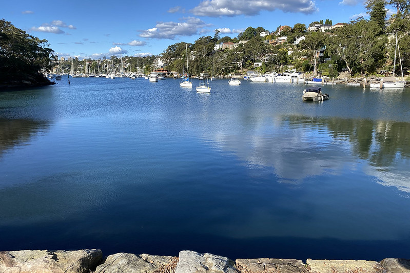
Flat Rock Creek flows (via the underground culvert) into this small cove, which is the end of Long Bay.

A panorama of the cove.

That was great! But I have to walk all the way back home. Unfortunately we're at sea level now... which means walking uphill. Up Brothers Avenue.

The road continues uphill, but we take the even steeper pedestrian steps up the hill in Judith Ambler Reserve. This is a shortcut leading us up the hill to Pine Street.

And these are the shortcut steps from Pine Street up to Tiley Street.

At Tiley Street we could continue up the hill...

But instead we turn right and take this pedestrian path across to Arkland Street.

There's no relief from walking uphill at Arkland Street, however! Cammeray is a very hilly suburb.

At the top of Arkland Street we reach Carter Street. Which continues uphill...

Eventually we reach the peak of Carter Street, near Echo Street. There's a tiny park here with this view to the south, towards North Sydney (right) and the central business district of Sydney itself beyond (background left).
At this point we're not far from the shopping strip of Cammeray, visited in detail in Walk 9. Crows Nest and Cammeray. So at this point I stopped taking photos, although I still had a long walk home.

Map of this walk. Beginning at the lower left, and proceeding clockwise.
Total recorded walking distance, including unshown legs from and back home: 12.48 km.